AREAS/POLYGONS
This function is mainly used to draw areas and load a previously made area.

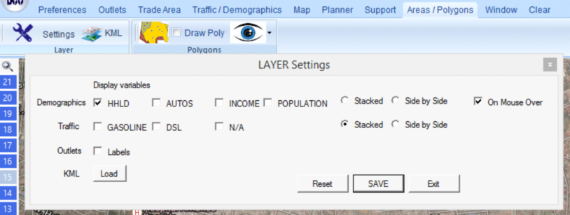
AREAS/POLYGONS-SETTINGS: This function brings the menu below. It allows the user to edit which variables can be viewed on the map when choosing labels, such as Gasoline traffic, Population, etc. These layers can be chosen to be viewed on the Map tab, and then selecting Layer Control.
AREAS/POLYGONS-DRAW POLY: This function allows you to create a polygon on the map by right clicking. Each click will create one of the corners of the polygon. When two points are created, they will be united by a purple line.
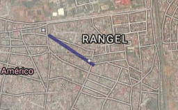
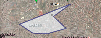
The polygon can be saved on the bottom menu. 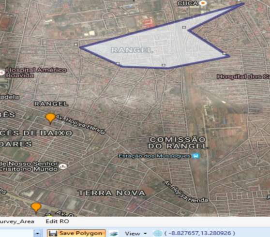
The save menu is shown below. It can be saved to an outlet, this means that the map will be associated with a particular outlet. One use of this function is to determine the area of influence that a particular outlet has.
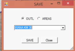
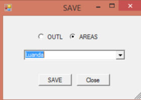
It can also be saved to an area instead it the polygon is not associated with any particular outlet.
Polygons can be used to determine cities, suburbs, areas, etc. They can also be used to show the stations that affect a particular outlet.